Twilight: 2000 - Rockall Travel Map
 |
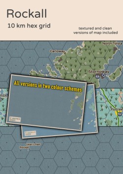
A travel map of the often overlooked but strategically invaluable British claim of Rockall. The map covers the Outer Herbides island chain of Scotland as well as the two fascinating strategic areas of St Kilda and Rockall.
The map is designed on indexed 10 km hexes and differentiates between several terrain types. Both road and rail networks as well as major waterways¸ large ports and airports are included for your convenient and safe travel. There are a total of 18 settlements/points of interest marked on the map and versions without overlaid settlement names are included as well. Note that due to the sparse population of rural Scotland¸ a lot of smaller villages have been included¸ mostly depending on their geographical location.
In addition to the image files¸ an index of all the settlements is included for quick reference with map grid coordinates. In order to make random encounters smoother¸ there's an included set of tables for the random generation of British settlement names.
A total of 12 files and 8 versions of the map are included. For the "clean” untextured versions¸ both PNG and JPG files have been provided. For the textured versions PNG files would be unreasonably large¸ so only JPG versions exist for those.
All versions of the map are presented in the original Polish map colour scheme as well as a new "British road atlas" scheme. Samples can be seen in the preview document.
This is the fifth in a series of 4 maps covering the whole British Isles.
Your support will help me invest more of my free time into this hobby and content creation.