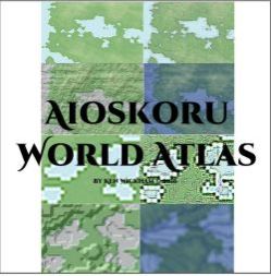
World Atlas
 |
ioskoru unlabeled four types of maps.
Customize the names and locations of cities for your version of the world.
Aioskoru comes to life with these 78 full page maps¸ default set to 22 x 22 inch PDF pages - though are printable to 8.5 x 11 standard if you print the page to fit. Four types of maps fill the book. A plain color flat¸ 3D bump¸ topographical contour line¸ and river/waterflow map for each of the panels - the two polar regions which only have the first three style maps. You may even screenshot and print zoomed portions of the map for your gaming needs.
The entire world maps are indexed on a single page indexed with an coordinates and active links going to every map.
The plain map is a color map shown in greens¸ blues¸ browns¸ and whites.
The 3D bump map shows rough texture based on light coming out of the northwest. It shows shadows and reveals mountains¸ valleys¸ possible lakes¸ hills¸ canyons¸ and other 3 dimensional features. It also reveals the depth of the see terrain.
The topographical map reveals the lines of altitude change. Instead of a numerical value¸ white bounderies indicate either a increase or decrease in altitude.
The river and water flow map reveals possible rivers or streams (or ancient rivers) made by a computerized flow of water. Decide whether the climate indicates they are rivers or not.
Five files included
- The instructions are included in a Read Me First document. 11 pages¸ at 1.18MB
- Aioskoru Scale¸ 1 page¸ 2.05MB
- Also included is the Aioskoru Oultine Maps which includes Adobe Acrobat X instructions and use as well as the entire world in outline with rivers set. With bookmarks¸ 38 pages¸ 8.81 MB
- The Aioskoru World Atlas with interactive table of contents¸ a key to the set with interactive links on one page¸ four types of maps¸ 18 addressed regions¸ three types of maps for polar regions - for a total of 78 color maps. With Bookmarks¸ 81 pages¸ 86.2MB