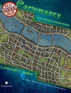
Lovecraft Country Map Pack: Cartomancy 23
 |
West of Arkham the hills rise wild¸ and there are valleys with deep woods that no axe has ever cut. There are dark narrow glens where the trees slope fantastically¸ and where thin brooklets trickle without ever having caught the glint of sunlight. On the gentler slopes there are farms¸ ancient and rocky¸ with squat¸ moss-coated cottages brooding eternally over old New England secrets in the lee of great ledges; but these are all vacant now¸ the wide chimneys crumbling and the shingled sides bulging perilously beneath low gambrel roofs.
Howard Phillips Lovecraft "HPL¸" The Colour Out of Space
Lovecraft CountyThe Massachusetts Northshore towns¸ nestled along the banks of the Miskatonic River¸ seem steeped in eldrith happenings and terrifying events. This Cartomancy Map Pack reveals 5 of them¸ for use in a 1920s game¸ as well as a map of the region. Includes 10 high resolution maps¸ suitable for large format printing or on-screen viewing.
These are for personal use only - Not Stock Art.
Lovecraft County MapThis map presents the locations and roads of the eastern part of it historic Lovecraft County¸ from Kingsport and Martin's Beach on the Atlantic coast¸ to storied Arkham itself just a few miles upriver¸ and then as far north as Newburyport on the Merrimac River¸ with Innmouth and Falcon Point located just east of Ipswich. Main roads¸ secondary roads¸ railroads¸ swamps¸ hills¸ lighthouses¸ and more are all present on the map. An inset map shows the entire Commonwealth¸ but only a few select towns¸ as found in the Miskatonic Valley. While the inset map doesn't show any roads¸ the Aylesbury Pike follows the Miskatonic (more-or-less)¸ from Arkham all the way to Aylesbury.
Arkham Maps- City Map
- Trolley Route Map
- Poverty Map (similar to Charles Booth's Victorian-era Poverty Maps of London)