Tasslehoff's Map Pouch: The Age of Mortals (3.5e)
 |
 |
Kender keep wandering off with our maps¸ but this time we've caught up with them! Straight from the pouch of the legendary Tasslehoff Burrfoot (the original)¸ we present a collection of a dozen maps set in the Age of Mortals. The collection starts with a full-sized poster map of Ansalon¸ continues with regional and location maps¸ and concludes with a pair of "kender"-style maps drawn by the irrepressible adventurer himself. The maps are sure to please fans of the novels and serve as a vital resource for game play!
Product History
"Tasslehoff's Map Pouch: The Age of Mortals" (2005)¸ by Sean Macdonald¸ is a gaming accessory produced by Sovereign Press for the Dragonlance 3e RPG line. It was published in March 2005.
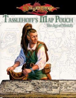
About the Cover. Each of the three Map Pouches shows Tasslehoff at a different age. "Age of Mortals" pictures the oldest Tasslehoff¸ no longer carrying his trademark hoopak.
Introducing the Map Pouches. Sean Macdonald didn't plan to become a roleplaying cartographer; instead¸ he started out as an internet programmer and website designer. However¸ he was also a Dragonlance fan. The combination of these interests led him to create the Kencyclopedia web site and later become a member of the Whitestone Council of the Dragonlance Nexus.
Dragonlance also led Macdonald to attend Gen Con¸ after a few of its books were nominated for ENnies. He was impressed by the cartography that was up for awards - and quickly realized that these maps were created by the same software that he used for his website designs. As soon as Macdonald got home¸ he began work on a map of the city of Flotsam. He showed that map to Jamie Chambers¸ who hired him on as a Dragonlance cartographer.
The three Tasslehoff's Map Pouches¸ starting with "The Age of Mortals"¸ are all imbued with Macdonald's artistic vision. Many of them are based on existing references¸ but he gives them a unique spin. Macdonald believes that maps should tell a story and be full of visual detail. If anything was unimportant¸ it was the exact measurements (though Macdonald's maps remain as accurate as possible). All of this is on display in the three Map Pouch releases (2005-2007).
This was not the first cartographic look at the Dragonlance world. Most of the major Dragonlance sourcebooks contained large-scale maps¸ while two in particular were quite well-loved. The Atlas of the Dragonlance World (1987) was the previous gold standard of cartography for fans of the novels¸ while RPG players loved to hang the big map from Tales of the Lance (1992) on their walls. TSR had also produced a small foldout Krynn map: TM3: "The World of Krynn Trail Map" (1989).
Expanding Krynn. "Age of Mortals" contains maps of numerous locations across "modern-day" Krynn:
- Ansalon. A pair of maps depicting all of Ansalon provided the first in-depth look at the continent following the War of Souls. The poster map is notable because it's also the first official recognition of Adlatum¸ a new continent that lies "to the west" of Ansalon. At the time¸ Adlatum was being created by a group of fans¸ who would eventually release a massive 300-page PDF: Adlatum (2008).
- Citadel of Light. Once the home of the mystics in the Fifth Age¸ now rebuilt as a home to mystics and clerics alike. The locale premiered in The Dawning of a New Age (1996) novel and had previously been detailed in the SAGA book The Citadel of Light (1998).
- Darkling Hall. An largely undeveloped location. It first appeared on the map from Tales of the Lance (1992) and received a paragraph of description in War of the Lance (2004). It was intended as a "blank land" for GMs to explore on their own.
- The Desolation. Ma